fournisseur de formation maritime certifié par DNV  |  CPG Group Provider  |  Online since 2018

Advanced · TC Exam

Navigation Systems
and Instruments (NS&I)

Prepare for the Transport Canada NS/I written exam by mastering every electronic and conventional navigation system found on a modern bridge.
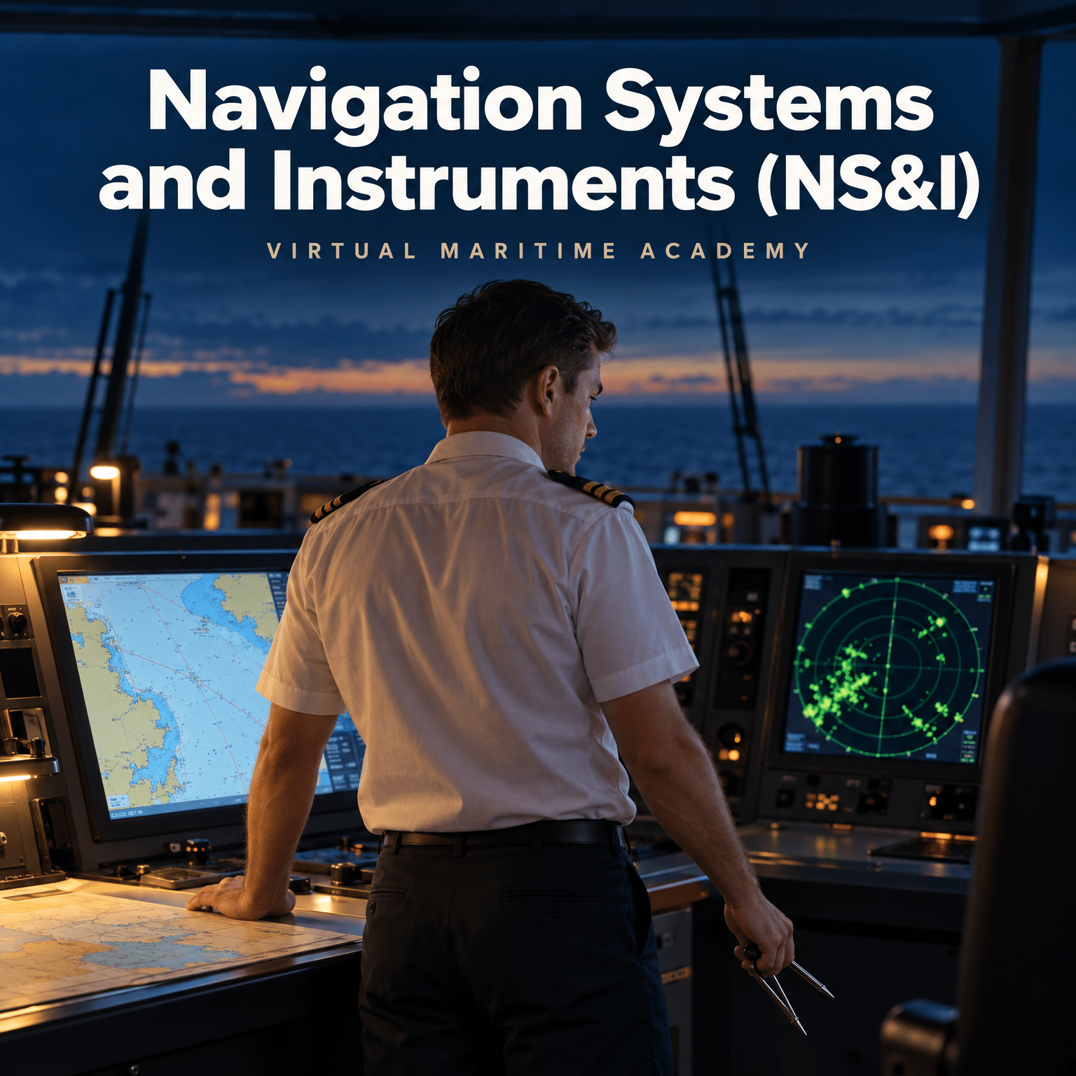
TP 2293 · NS/I Exam Prep100% Online · Self-Paced20 Chapters · 51 Hours
51
Hours
20
Chapters
6
Months access
Get Your Navigation Systems and Instruments (NS&I) Certificate
51 hours · 6 months of access
Navigation Systems and Instruments (NS&I)
51 hours · 6 months of access
$ 499 USD
Course Overview

Master every system on the bridge, and the exam that tests it

Navigation Systems and Instruments (NS&I) is a self-paced online course built around the Transport Canada NS/I written examination. It covers the operating principles, sources of error and practical limitations of every electronic and conventional navigation system carried on a modern bridge, from satellite positioning and ECDIS to gyrocompasses, magnetic compasses and dynamic positioning.

Across 20 chapters, you will work through the regulatory framework governing bridge equipment, learn to cross-check one navigational aid against another, and build the fallback competence a watchkeeper needs when a primary sensor fails or misleads.

Each chapter ends with its own quiz, so you can confirm your understanding before moving on, progressing entirely online and at your own pace.

Renseignement
Duration51 hours
DifficultyAvancé
CategoryTC Exam
Delivery100% online, self-paced
Content20 chapters, a quiz after each
Why Choose Virtual Maritime Academy

Developed by experienced maritime professionals

Our courses are developed by experienced maritime professionals and are designed to provide practical knowledge and competency-based learning for today's maritime industry. On successful completion, participants receive a certificate issued by the Virtual Maritime Academy.

A digital certificate is delivered by email upon successful completion.

Competencies achieved
Prepare confidently for the Transport Canada NS/I written examination
Explain the operating principles and limitations of every electronic and conventional navigation system
Detect misrepresented navigational information and recover a reliable position when a sensor fails
Determine and apply gyrocompass and magnetic compass errors
Assess carriage, type-approval, visibility and ergonomic requirements for bridge equipment
Evaluate data integrity across an integrated bridge system
Navigate safely in high latitudes and during dynamic positioning operations
Maintain and test bridge equipment safely, identifying electrical faults correctly
Objectifs d'apprentissage

On successful completion, you will be able to:

These are the learning outcomes established in the course syllabus, Revision 2, 2026.

  • ✓Prepare with confidence for the Transport Canada Navigation Systems and Instruments (NS/I) written examination and demonstrate the depth of knowledge its descriptive questions require
  • ✓Explain the operating principles, sources of error and practical limitations of every electronic and conventional navigation system carried on a modern bridge
  • ✓Detect misrepresentation of information from any navigational aid and apply the cross-checking discipline that recovers a reliable position when a primary sensor fails
  • ✓Determine and apply gyrocompass and magnetic compass errors, and account for the ship magnetism, heeling and retentive effects that produce them
  • ✓Assess the regulatory, physical and operator requirements governing bridge equipment, including carriage, type approval, visibility, ergonomics and electromagnetic compatibility
  • ✓Evaluate the integrity of data flowing through an integrated bridge system and identify where a single corrupted input can propagate across every display
  • ✓Navigate safely in high latitudes and in dynamic positioning operations, allowing for the compass, charting and celestial limitations peculiar to those environments
  • ✓Maintain, test and document bridge equipment safely, identifying electrical faults correctly and guarding against the hazards associated with electrical equipment
Course Content

Twenty chapters, one exam-ready skillset

Each chapter ends with its own quiz, drawn from a 60-question bank, to reinforce key learning objectives. Select a chapter to read what it covers.

—Introduction
Course overview
Competences to be achieved
01Introduction to Electronic Navigation Systems
The Role of Electronic Aids in Modern Navigation – From Celestial Fixes to Sensor Fusion
Benefits of Electronic Navigation – Accuracy, Continuity and Situational Awareness
Limitations and Fallibility – The Failure Modes Every Watchkeeper Must Anticipate
Redundancy and Traditional Competence – Why the Fallback Skills Remain Examinable
Case Study – The Royal Majesty Grounding and the Anatomy of a Silent Failure
The Bridge Navigational Ecosystem – Interfaces, Data Flow and Sensor Dependency
Cross-Verification Principles – Building an Independent Check into Every Watch
The Regulatory and Examination Framework – SOLAS, IMO Performance Standards and TP 2293
02Bridge Equipment Regulations and Requirements
SOLAS Chapter V – The Carriage Requirements and How They Scale with Tonnage
Mandatory, Duplicated and Alternative Equipment – Reading Regulation 19 Correctly
IMO Performance Standards and Type Approval – What an Approval Certificate Guarantees
Canadian Application – The Navigation Safety Regulations 2020 and Transport Canada Oversight
Bridge Design, Field of Vision and Blind Sectors – SOLAS V/22 in Practice
Bridge Ergonomics and Workstation Layout – Conning, Monitoring and Manual Steering Positions
Electromagnetic Compatibility – Interference Paths, Cabling, Bonding and Safe Distances
Maintenance, Surveys, Records and Defect Reporting – Keeping Equipment Legally Operational
03Satellite Navigation and Position Fixing
GNSS Architecture – Space, Control and User Segments of GPS, GLONASS and Galileo
Satellite Orbits and Constellation Geometry – Planes, Inclination, Period and Visibility
The Ranging Principle – Trilateration, the Receiver Clock Unknown and the Fourth Satellite
Signal Structure and Transmitted Codes – Frequency Bands, C/A and P(Y) Code, Navigation Message
Pseudo-Range Measurement – Code Correlation, Clock Bias and Why It Is Not a True Range
WGS-84 and Coordinate Reference Systems – Datum Mismatch and Its Effect on Charted Position
Differential and Augmentation Systems – DGPS, DGLONASS, WAAS and Other SBAS
Error Sources, Dilution of Precision and Accuracy After the Abolition of Selective Availability
Integrity, Failure Warnings, Doppler Velocity Output, Jamming and Spoofing
04Terrestrial Radio Navigation Systems
Hyperbolic Position Fixing – The Time-Difference Principle and Lines of Position
Loran-C Chain Structure – Master and Secondary Stations, GRI, Coding and Emission Delay
The Pulse System and Cycle Matching – Resolving Ambiguity and Identifying the Correct Cycle
Propagation, Groundwave and Skywave – Accuracy, ASF Corrections and Coverage Diagrams
Limitations, Frequent Checking, Coverage Areas and the eLoran Case for GNSS Backup
05Electronic Charting and Voyage Planning (ECDIS and ECS)
ECDIS in the Regulatory Framework – Carriage, Type Approval and the Paperless Bridge
Chart Data – ENC, RNC, S-57 and S-63, and the Move to S-100 and S-101
Approved ECDIS versus Electronic Chart Systems – The Legal and Practical Difference
Voyage Planning in ECDIS – Route Construction, Safety Contour, Safety Depth and Check Route
Route Monitoring, Alarms and Indications – Look-Ahead, Cross-Track Error and Alarm Management
Radar and AIS Overlay, Sensor Discrepancy and Documented Misinterpretation Cases
06Depth Sounding and Sonar Technologies
Echo-Sounding Principles – Acoustic Ranging, Velocity of Sound and Depth Computation
System Architecture – Transmitter, Transducer, Receiver, Indicator and Recorder Block Diagram
Display Types, Phased Scales and Recorder Interpretation
Repetition Rate, Pulse Length, Minimum and Maximum Depth and Achievable Accuracy
Interference and Noise – Internal, Water-Borne, Aeration, Multiple Echoes and False Bottoms
Sonar and Forward-Looking Sonar – Principles, Practical Application and Limitations
07Automatic Identification System (AIS)
AIS Purpose, Carriage Requirements and Performance Standard
SOTDMA, Channel Access and Reporting Intervals – How the Slot Map Works
Static, Dynamic, Voyage-Related and Safety-Related Message Content
Operating Modes, Class A and Class B, AIS AtoN, AIS-SART and Long-Range Interrogation
Integration with Radar and ECDIS – Target Association, Symbology and Discrepancy Handling
Limitations, Data Quality, Spoofing and the Role of AIS in Collision Avoidance
08Speed and Distance Measurement Systems
The Regulatory Requirement – What Must Be Provided, Through Water and Over Ground
Electromagnetic Logs – The Faraday Principle, Sensor Types, Calibration and Errors
Doppler Logs – Janus Configuration, Bottom Track and Water Track, Single and Dual Axis
Pressure, Impeller and Correlation Logs – Legacy Principles and Residual Relevance
Data Distribution to ARPA, Track Control and VDR – Why the Speed Reference Must Be Correct
09Sound Reception Systems
The Requirement – Totally Enclosed Bridges, COLREG Rule 5 and SOLAS V/19
Functional Requirements and Performance Standard – Detection, Bearing Sectors and Audibility
Microphone Arrays and Signal Processing – Siting, Wind Noise and Bearing Discrimination
Presentation to the Watchkeeper – Visual Indication, Loudspeaker Reproduction and Bridge Noise
Installation, Testing, Maintenance and Operational Limitations
10Integrated Bridge Systems (IBS)
What Makes a System Integrated – IBS, INS, Multifunction Workstations and Performance Standards
Architecture and Data Distribution – IEC 61162, NMEA Sentences, Networks and Interfacing
Data Integrity and Quality – Sensor Validation, Consistency Checking and Single-Point Dependency
Failure Modes and Fallback – Degradation, Backup Arrangements and Manual Reversion
Human Factors – Automation Complacency, Mode Awareness, Alarm Management and Training
Assessing the Benefit of Integration for a Particular Vessel Operation
11High-Precision Position-Fixing Systems
Why High-Precision Systems Exist – Survey, Offshore and Pilotage Accuracy Requirements
Microwave Ranging Systems – Trisponder, Mini-Ranger and MRD-1
UHF and Medium-Frequency Ranging – Syledis B, Trident III and Argo
Hyperbolic and Phase-Comparison Systems – Decca Hi-Fix/6 and Raydist
Range-Range versus Hyperbolic Geometry – Baseline, Lane Ambiguity and Fix Accuracy
Calibration, Operational Limitations and Why the Legacy Knowledge Remains Examinable
12Dynamic Positioning Systems (DPS)
DP Principles – Station-Keeping, the Three Controlled Axes and the Control Loop
DP Classes, Redundancy and the IMO Guidelines for Vessels with Dynamic Positioning Systems
Position Reference Systems I – Taut Wire, Acoustic HPR and HPNS, and Riser Angle
Position Reference Systems II – DGNSS, RTK, Radar-Based and Laser-Based References
Heading, Motion and Environmental Sensors – Gyro, Motion Reference Units, INS and Wind
Thruster Allocation, Power Management and Consequence Analysis
Failure Modes, Drive-Off, Drift-Off and the DP Operator's Response
13Voyage Data Recorder (VDR)
Purpose, Regulatory Intent and Carriage Requirements for VDR and S-VDR
The Required Data Set – Items, Sampling Intervals and Retention Periods
Capsule Types, Float-Free and Fixed Recording Media, and Long-Term Storage
Event Save, Data Download and the Incident Recovery Process
Annual Performance Test, Battery Checks, Maintenance and Common Defects
14Timekeeping and Time Systems in Navigation
Time Scales – UT1, UTC, TAI, GPS Time, GLONASS Time and Galileo System Time
Leap Seconds, Epochs, Week-Number Rollover and Their Navigational Consequences
Why Timing Accuracy Governs Positional Accuracy – One Microsecond Expressed in Metres
Onboard Time Distribution and Synchronisation – ZDA Sentences, VDR and ECDIS Time Stamps
Chronometers, Radio Time Signals and Backup Practice for Celestial Observation
15Navigating in High Latitudes
The High-Latitude Environment – Rapidly Changing Weather, Low and Ice-Masked Coastlines
Convergence of Meridians, Chart Projections and Non-Triangulated Charts
Magnetic Compass Behaviour – Low Horizontal Intensity, High Dip and Rapid Variation Change
Gyrocompass Limitations at High Latitude and the Available Alternatives
Extreme Refraction, False Horizons and Extended Twilight
Celestial Practice in Polar Regions – Low Altitudes, Front and Back Altitudes, Body Selection
Maintaining Track and Estimated Position – Loss of Plotting Accuracy and EP in Heavy Weather
16Theory of Errors and Accuracy of Position Fixes
The Nature of Error – Mistakes, Constant (Systematic) Error and Random Error
Errors in Position Lines – Bearing Error, Range Error and the Shape of the Cocked Hat
The Most Probable Position – Symmedian Point, Weighting and the Bisector Method
Statistical Description of Accuracy – Standard Deviation, CEP, RMS and 95 Per Cent Confidence
Error Ellipses, Angle of Cut and the Geometry of a Reliable Fix
Applying Error Theory on Watch – Deciding When a Fix Is Good Enough
17Electrical Safety and Bridge Equipment Maintenance
Electrical Hazards on the Bridge – Shock, Arc Flash, Stored Energy and Radiation
Isolation, Lock-Out and Tag-Out, Permits to Work and Safe Working Practice
Fault Identification – Symptoms, Test Instruments and Systematic Diagnosis
Antennas, Radar Radiation Hazards and Precautions for Working Aloft
Planned Maintenance, Spares, Manufacturer Servicing and Record Keeping
Emergency Response to Electrical Failure and Restoring Navigational Capability
18Gyrocompass Systems and Heading Sensors
Properties of the Free Gyroscope – Rigidity, Precession and the Applied-Force Relationship
Converting a Free Gyroscope into a North-Seeking Compass – Control and Damping
Fundamental Classes of Gyrocompass According to Control and Damping
Gyrocompass Errors – Latitude, Course and Speed, Ballistic Deflection and Rolling Error
Determining and Applying Gyro Error – Corrections, Azimuth Checks and Record Keeping
Modern Types – Digital, Ring-Laser and Fibre-Optic Gyroscopes and Their Behaviour
Repeater Systems, Transmitting Heading Devices and Performance Standards
19Automatic Steering and Control Systems
Systems Under the Control of the Master Gyro – Distribution, Repeaters and Consumers
Heading Control Systems and Autopilots – Definitions and the Difference That Matters
Autopilot Architecture – Error Signal, Rudder, Counter-Rudder, Weather and Permanent Helm
Adaptive and Self-Tuning Autopilots – Setting Up for Sea State, Loading and Speed
Track Control Systems – ECDIS Integration, Turn Radius, Wheel-Over and Operational Limits
Rate-of-Turn Indicators – Principles, Performance Standards and Use in Pilotage
Alarms, Indicators, Fall-Back Arrangements and Changeover to Manual Steering
20Magnetic and Fluxgate Compass Systems
The Laws of Magnetism and Terrestrial Magnetism – Variation, Dip and Field Components
Compass Construction, the Binnacle and Siting Requirements
Ship Magnetism – The Permanent Components P, Q and R and the Induced Components
Deviation – Coefficients A to E, Obtaining and Recording a Table of Deviations
Compass Correction – General Principles, Correctors and the Order of Correcting
Heeling Error, Heeling Magnets and Their Effect on Soft-Iron Correctors
Retentive Magnetism, Gaussin Error and Post-Drydock Compass Behaviour
Electromagnetic and Fluxgate Compasses, TMHDs and Comparison with the Gyrocompass
Course Assessment
Chapter quiz after each of the 20 chapters
60-question bank per chapter, 70% to pass, 2 attempts
No final examination
Student ID Verification, mandated by DNV
Digital certificate delivered by email

Revision 2, 2026.

Who Should Attend

This course is designed for deck officers preparing for the Transport Canada Navigation Systems and Instruments (NS/I) written examination.

It is particularly relevant for
Deck officers preparing for the Transport Canada Navigation Systems and Instruments (NS/I) written examination
Assessment & Certification

Twenty chapter quizzes, no proctored final exam

Each of the course's 20 chapters ends with its own quiz, drawn from a bank of 60 questions, with a minimum score of 70% required to pass and two attempts per quiz. There is no separate proctored final examination.

Before starting the course, students complete a Student ID Verification step, mandated by DNV.

Certificat
On successful completion you receive a Virtual Maritime Academy Certificate of Completion, delivered digitally by email. No hardcopy is issued for this course.
Important Note
A fee may apply to re-attempt a chapter quiz beyond the attempts included.
Technical Requirements
Appareil — a computer or tablet with a webcam.
Operating system — Windows 10 or later, macOS 11 or later.
Browser — Google Chrome or Mozilla Firefox, latest version recommended.
Internet — minimum 3 Mbps upload and download speed.
Matériel — minimum 8 GB RAM, functional webcam, microphone and speakers or headset.
Normes, règlements et lignes directrices couverts

The instruments this course draws on

This course is built on the following conventions, codes and guidance.

TP 2293 (Transport Canada)
SOLAS Chapter V
STCW 2010, Tables A-II/1 and A-II/2
COLREG 1972
IMO Performance Standards (MSC Resolutions)
IEC 61162 and IEC 62288
IHO S-57, S-63 and S-101
IALA
Navigation Safety Regulations 2020 (Canada)
Get Certified

Walk into the NS/I exam ready

Transport Canada's NS/I examination tests descriptive knowledge across every electronic and conventional navigation system a watchkeeper relies on, and the judgment to know when one of them is wrong.

This course builds that knowledge and that judgment, chapter by chapter, entirely online, in approximately 51 hours, at your own pace.

Learn It · Verify It · Pass the Exam
Course at a Glance
LevelAvancé
Duration51 hours
Access6 months
Évaluation20 chapter quizzes, 70% to pass, no final exam
$ 499 USD
Inscription

Revision 2, 2026. Certificate delivered digitally by email; no hardcopy for this course.

Scroll to Top